The Mt. Baker Highway (SR 542), Mile by Mile
From Bellingham's Exit 255 to Artist Point at 5,075 feet: what sits at every milepost on SR 542 — fuel, food, trailheads, and where the pavement ends.
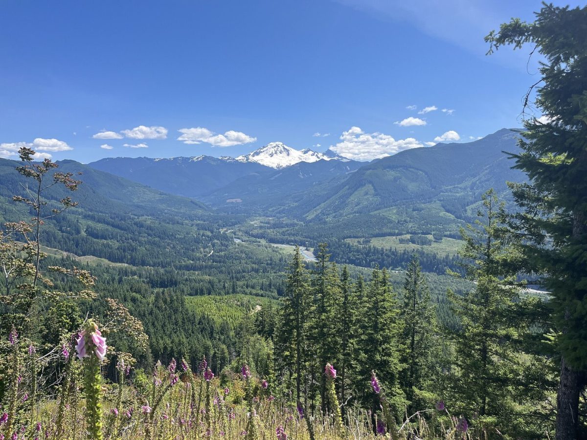
SR 542 runs about 58 miles from I-5 Exit 255 in Bellingham to Artist Point at 5,075 feet, climbing from sea level to the highest point reachable by paved road in the North Cascades. Glacier, the last town, sits at mile 34. The ski area's two base lots are at miles 52 and 55. Below is what's actually at each stretch — where to fuel up, where the pavement gets narrow, and where you'd need to call ahead before driving further.
The corridor at a glance
| Milepost | Place | What's there |
|---|---|---|
| MP 0 | Bellingham, I-5 Exit 255 | Hospital, airport (BLI), all grocery chains, gear shops — the last full-service town on the route |
| ~MP 10 | Nugents Corner | Nugents Corner Market & Hardware |
| ~MP 15 | Deming | North Fork Brewery, Welcome Store, Nooksack Market Center (cheapest fuel on the corridor) |
| ~MP 22 | Kendall | Starvin' Sam's #15 Valero, with Hot Stuff Pizza |
| ~MP 28 | Maple Falls | Maple Fuels–Shell (last fuel before the mountain, closed Sundays), Crossroads Grocery, Mt. Baker Visitor Center |
| MP 34 | Glacier | Last settlement. Chair 9, Graham's, Wake 'N Bakery, Glacier Public Service Center |
| MP 52 | White Salmon base | Ski area, 4,300 ft |
| MP 55 | Heather Meadows base | Ski area upper lot |
| ~MP 58 | Artist Point | 5,075 ft, roughly 160-car lot, around 650 vehicles a day in season |
Drive time from Bellingham to the ski area runs about 90 minutes for the 52-mile stretch, assuming clear roads and no stops. Add time for every stop below — there are more worth making than the number suggests.
Bellingham to Deming: the last of everything
Leaving I-5 at Exit 255, you're on SR 542 immediately, and for the first fifteen miles the highway still feels like a regular state road — wide lanes, steady traffic, services within reach. This is your last chance at a hospital (PeaceHealth St. Joseph), an airport (BLI), and a full grocery chain before the corridor thins out.
Nugents Corner, around mile 10, has a market and hardware store — useful for something forgotten, not a destination stop. Deming, around mile 15, is more substantial: North Fork Brewery — locally known as "the Beer Shrine" — runs a brewery, pizzeria, and wedding chapel out of one building at 6186 Mt Baker Hwy, and it's a genuine corridor landmark rather than a roadside curiosity. The Welcome Store nearby handles deli and liquor, open 6 a.m. to 10 p.m. daily. Nooksack Market Center, also in Deming, has the cheapest gas on the entire highway, open 6 a.m. to midnight — worth knowing if you're filling up for the whole trip rather than topping off later.
Kendall to Maple Falls: your last fuel window
Kendall, around mile 22, is little more than Starvin' Sam's #15 Valero, but it's open roughly 5 a.m. to 11 p.m. with Hot Stuff Pizza attached — a legitimate option if you're driving through at odd hours.
Maple Falls, around mile 28, matters more than its size suggests. Maple Fuels–Shell at 7797 Silver Lake Rd is the last fuel stop before the mountain, open 6 a.m. to 9 p.m. Monday through Saturday — and closed on Sundays. If your trip lands on a Sunday, fill up before Maple Falls or plan to arrive with enough in the tank to get back to Deming. Crossroads Grocery, also in Maple Falls, is open 7 a.m. to 10 p.m. daily for basics. The Mt. Baker Visitor Center at 7509 Mt Baker Hwy has public Wi-Fi and a staffed desk — reachable at (360) 599-1518 — and is a sensible last stop for current trail and road information before you lose signal further up the highway.
Glacier: the last settlement
Glacier sits at mile 34 and is the final town before the ski area — worth stating plainly, since Glacier and Mt. Baker Ski Area are not the same place and are roughly 17 miles and 30 minutes apart. Chair 9 Woodstone Pizza & Sports Bar at 10459 Mt Baker Hwy is open and well-reviewed. Graham's Restaurant and Store at 9989 Mt Baker Hwy has run under Shirley Schmidt since December 2019, serving Monday through Thursday noon to 9 p.m. and Friday through Sunday noon to 10 p.m., with the store open 8 a.m. to 8 p.m. and an ATM on site. Wake 'N Bakery at 6903 Bourne St rounds out the food options.
What Glacier doesn't have is worth saying just as plainly: no pharmacy, no urgent care, and no full grocery store. The nearest of any of those is Bellingham, 45 to 60 minutes back down the highway. If you're staying in cabins near Glacier, plan your prescriptions and big grocery runs before you arrive, not after.
The Glacier Public Service Center, at 10091 Mt Baker Hwy, is open daily 8:00 a.m. to 4:30 p.m. year-round with a 24-hour self-service kiosk outside. It sells Northwest Forest Passes and America the Beautiful passes, and it's the number to call — (360) 599-2714 — before driving to any trailhead reached by an unpaved forest road past this point.
Side roads worth knowing about — and two you should call ahead for
Several gravel forest roads branch off SR 542 between Glacier and the ski area, leading to some of the corridor's best-known trailheads. Two of them currently have real access problems.
Glacier Creek Road (FR 39), which reaches the Heliotrope Ridge trailhead, has been storm-damaged since November 2021. As of this writing, repairs were slated to begin around mid-July 2026 with a target reopening by the end of September, though a separate closure order restricted vehicle access from the Glacier Creek bridge to the trailhead starting 30 June 2026, with foot or bike access allowed at the district's discretion. The practical upshot is extra miles on foot or bike beyond wherever your vehicle actually has to stop. Call Glacier Public Service Center at (360) 599-2714 before you drive up expecting to reach the trailhead.
Deadhorse Creek Road (FR 37), the access road for Skyline Divide, is washed out with a vehicle closure at mile 3.1. Repairs began in June 2026 on roughly a two-year timeline. Same rule applies: call ahead.
Two more side roads are worth a mention without the same warning attached. Wells Creek Road (FR 33), off the highway about 7.4 miles past Glacier, reaches the short, no-permit-required trail to Nooksack Falls — a fenced viewing platform above a PSE hydro plant, about three-quarters of a mile in. Beyond the falls, the road carries a seasonal wildlife closure from November through June and has seen intermittent erosion closures. Twin Lakes Road (FR 3065) has no formal closure order but is described as extremely rough; most hikers park at the Yellow Aster trailhead 4.5 miles in and walk the remaining 2.5 miles rather than push a passenger car further.
Canyon Creek Road, which accesses Excelsior Peak and Damfino Lakes, washed out in December 2025 with no repair timeline as of this writing — and sources disagree on its actual forest road number, so treat any number you see for it as unconfirmed until checked against a current Forest Service map.
White Salmon and Heather Meadows: the ski area
At mile 52, White Salmon is the ski area's lower base, sitting at 4,300 feet. Three miles further, at mile 55, Heather Meadows is the upper base lot. Both areas are strictly day-use — none of the corridor's lodging is on the mountain, and there's no ski-in/ski-out access anywhere on this highway.
The final stretch: Heather Meadows to Artist Point
The last 2.7 miles of the highway, from Heather Meadows to Artist Point, is a genuinely seasonal road. It closes with the first significant snowfall of the year and doesn't reopen until crews clear it — a job that took clearing up to 20 feet of accumulated snow before the road opened 10 June 2026. In 2025 it opened 27 June and closed 15 October. In 2024 it opened 21 June. That's a real spread from year to year, so check current status rather than assuming a fixed date.
Artist Point itself sits around mile 58 at 5,075 feet, with a roughly 160-car lot that fills on busy days — the area sees around 650 vehicles daily during peak season. This is also where Picture Lake, near Heather Meadows, produces the reflection photo everyone associates with "Mt. Baker" — worth knowing that the peak in that famous shot is actually Mt. Shuksan, not Baker itself.
A handful of short trails start right from these upper lots without any additional driving. The Bagley Lakes trail, 2.0 miles round trip with 150 feet of gain, starts from the Heather Meadows upper lot and holds a snowfield most of the year — it's a quieter alternative to the crowds at Artist Point itself. From Artist Point, Table Mountain is a short 2.6-mile round trip with 725 feet of gain, but don't let the modest mileage fool you: the trail crosses loose scree with exposed edges and has caught out hikers who expected something casual. The Chain Lakes Loop, also from Artist Point, runs 6.5 miles with 1,820 feet of gain past Iceberg, Hayes, Arbuthnot and Mazama lakes, with blueberries ripening along the route in late summer.
Cell coverage along the way
Signal holds reasonably well through Bellingham, Deming, and the lower corridor, then degrades noticeably past Glacier. If you're navigating by phone or relying on it for a conditions check, download maps and information before you lose the lower-corridor towers. Our cell service guide breaks down where coverage actually ends.
Winter driving on SR 542
Above Glacier, the highway climbs steadily, narrows, loses lighting, and is often snow-packed through the winter months. Washington's traction rules apply in three tiers — Level 1 requires traction tires unless you're in a 4WD or AWD vehicle with adequate tread, Level 2 requires chains except for 4WD/AWD, and Level 3 requires chains for every vehicle regardless of drivetrain. These are posted per-route in real time, so check WSDOT's SR 542 alert page before you drive rather than relying on what you saw last trip. Carry chains regardless of what you're driving. For a longer look at seasonal closures and how to check conditions before you leave, see our road conditions guide.
If you're coming from Bellingham, our drive-time breakdown covers the lower corridor in more detail. If you're coming from Vancouver, BC, the route joins SR 542 from a different direction — see our border crossing and drive guide for that version of the trip.
FAQ
How long is SR 542?
About 58 miles from I-5 Exit 255 in Bellingham to Artist Point.
Where's the last gas station before the mountain?
Maple Fuels–Shell in Maple Falls, around mile 28, open 6 a.m. to 9 p.m. Monday through Saturday and closed Sundays. Nooksack Market Center in Deming, around mile 15, has the cheapest gas on the corridor if you'd rather fill up earlier.
Are Glacier and the ski area the same place?
No. Glacier is at mile 34; the ski area's two bases are at miles 52 and 55 — about 17 miles and 30 minutes further up the highway.
Can I drive all the way to Artist Point?
Only when the road is open, which varies by year with snowpack. It typically opens sometime in June and closes again by mid-October, but check current status before planning around a specific date.
Do I need a pass to stop at any of these trailheads?
Most USFS trailheads along this corridor require a Northwest Forest Pass, sold at the Glacier Public Service Center. Nooksack Falls and a few others don't — worth checking per trailhead before you go.
Check WSDOT's alert page and mtbaker.us before you drive, especially outside summer.
*Written by the team at Stay at Mt Baker, who manage cabins in Glacier, Maple Falls,
Mt. Baker Rim, Glacier Springs, Snowline, Snowater and Silver Lake.
Last checked: August 2026.*