Mt. Baker Highway Road Conditions: How to Check Before You Drive
SR 542 has closed for weeks from storm damage before. Here's where to check current conditions, what the traction-tire levels mean, and a real case study.
Check WSDOT's SR 542 alert page and mtbaker.us before every trip up this highway, not just in winter. The road has closed completely for weeks at a stretch from storm damage as recently as the 2025–26 season, and mileposts you'd drive through without a second thought — Wells Creek at MP 41, O'Keefe Creek at MP 43 — are exactly where it happened. Both sit well past Bellingham; see how far Mt. Baker is from Bellingham for the mile-by-mile breakdown of that stretch.
Where to actually check
Two sources cover this corridor well, and they answer different questions.
WSDOT's real-time alert page for SR 542 is the authority on closures, lane restrictions, and construction — the kind of thing that can change the drive from "open" to "one lane, 6 a.m. to 6 p.m." overnight. Check it at wsdot.com/travel/real-time/alerts/road/542 before you leave, not after you've already loaded the car.
mtbaker.us covers the ski area's own snow report and operational status, which is useful context even if you're not skiing — heavy snow that closes lifts is often the same weather closing the road behind it.
If your trip involves any backcountry terrain, add NWAC (nwac.us) to the list. It covers avalanche conditions, not road status, but the two are often connected during storm cycles.
What "closed" actually means on this highway
Closures here aren't always a full gate-down stop. They range from a complete closure with no through traffic, to alternating one-lane traffic controlled by flaggers or a signal, to a reduced speed limit through an active repair zone. The distinction matters for trip planning — a one-lane closure with daytime hours might add twenty minutes if you time it right, or an hour if you show up at the wrong end of the window.
Case study: the December 2025 Wells Creek washout
The most instructive recent example is worth walking through, because it shows how fast conditions can change and how long recovery can take.
| Date | Event |
|---|---|
| December 2025 | An atmospheric river storm erodes a 110-foot embankment near Wells Creek (MP 41) and damages a 70-foot section near O'Keefe Creek (MP 43) |
| Mid-December 2025 | Highway closes completely around MP 35, delaying the ski season's opening |
| 21 December 2025 | Road reopens to alternating one-lane traffic, 6 a.m. to 6 p.m. |
| 19 January 2026 | Permanent repairs begin (Granite Construction) |
| Early February 2026 | A five-day full closure for the final phase of repair work |
| 6 February 2026 | Highway fully reopens |
That's nearly two months from the initial washout to full reopening, and the ski season itself was delayed by it. None of this was visible from a Bellingham forecast — the storm that caused it was an atmospheric river event, the kind of Pacific Northwest weather pattern that can drop an enormous amount of rain on already-saturated ground at elevation. If you'd checked WSDOT's alert page the morning of a planned trip during this window, you'd have known before you were an hour up the highway with nowhere to turn around.
The broader lesson isn't about this specific storm — it's that a highway squeezed between a river and a mountainside, climbing through steep terrain, is genuinely vulnerable to this kind of damage, and it has happened recently enough that "check before you drive" isn't boilerplate advice.
Winter traction requirements
Washington posts traction restrictions in three tiers, and SR 542 above Glacier — steep, winding, unlit in places, and often snow-packed — is a route where they're regularly in effect during winter.
| Level | Requirement |
|---|---|
| Level 1 | Traction tires advised or required, except 4WD/AWD vehicles with adequate tread |
| Level 2 | Chains required, except 4WD/AWD vehicles |
| Level 3 | Chains required for all vehicles, including 4WD and AWD |
These restrictions are posted per-route in real time on WSDOT's site, so the level in effect on any given day depends on current conditions rather than the calendar. Carry chains regardless of what you're driving — a 4WD exemption from a Level 1 or 2 requirement isn't the same as guaranteed traction on a packed, icy grade. Our winter packing guide covers what else belongs in the car for this drive.
Chains for the ski area vs. chains for your cabin
Most road-condition advice for this corridor is written for skiers heading to the lifts, and it isn't always relevant if your destination is a cabin well below the ski area. The steep, winding, unlit sections of SR 542 that trigger chain and traction requirements most often are above Glacier, on the climb toward White Salmon and Heather Meadows. A cabin in Maple Falls or near Glacier itself sits on a lower, less exposed stretch of the same highway. That doesn't mean winter driving there is risk-free — packed snow and ice happen at any elevation on this corridor — but it does mean you should check the specific milepost range named in a WSDOT alert rather than assuming a restriction posted for the upper highway applies to your entire drive. If an alert specifies mile 45 and above, and your cabin turnoff is at mile 28, that's a materially different situation than if the alert covers the whole route.
The same logic applies in reverse: don't assume that because the lower corridor is clear, the upper highway is too. Storm systems here can produce a rain-to-snow transition with elevation, so conditions at your cabin and conditions eight or ten miles further up can be genuinely different weather.
Forest roads are a separate question
Everything above concerns SR 542 itself. The gravel forest roads branching off it — to Heliotrope Ridge, Skyline Divide, and several other trailheads — have their own, often worse, closure situations, and some have been washed out for years rather than weeks. Never drive toward one of those trailheads assuming the access road is passable; call Glacier Public Service Center at (360) 599-2714 first. Our mile-by-mile highway guide covers which specific side roads are currently affected.
Why this corridor is prone to closures at all
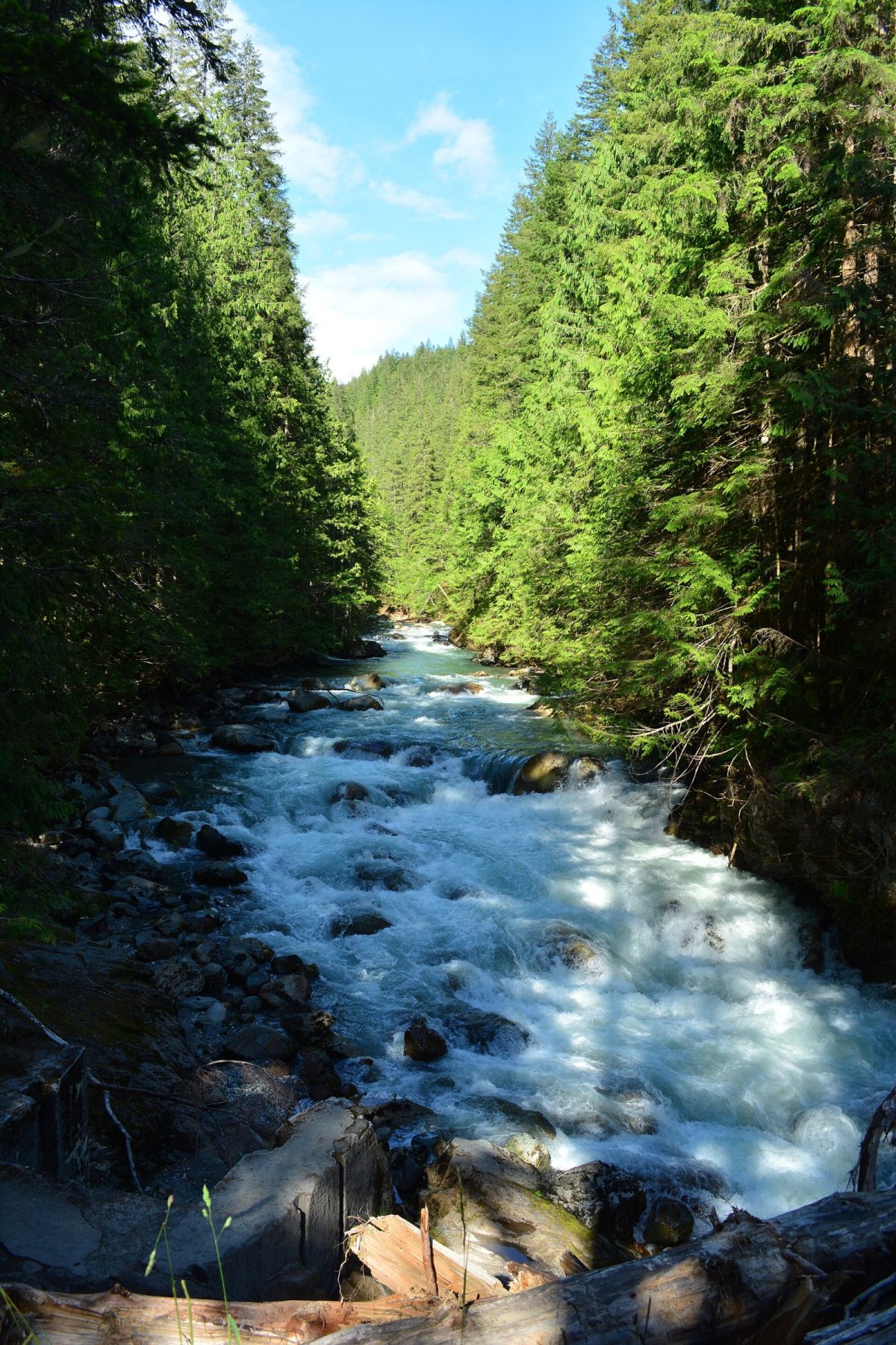
SR 542 above Glacier runs along steep terrain squeezed between drainages coming off Mt. Baker's flanks — Wells Creek and O'Keefe Creek among them. Water moving fast off that terrain during a heavy rain event, especially one landing on ground already saturated from earlier storms, can undercut a roadbed built into a hillside far faster than it could on flatter ground. That's the mechanism behind the December 2025 washout, and it's not a one-off quirk of that particular storm — it's a structural feature of building a highway through this kind of terrain. It's also why repairs here tend to run long: rebuilding an eroded embankment on a mountainside isn't a pothole patch, and the Wells Creek work took from the initial storm damage through early February to fully resolve.
Before you leave for a booked stay
If you've got a cabin booked for a specific weekend, check conditions the morning you leave rather than when you booked weeks earlier. Corridor weather and road status can shift within days, and a check five minutes before you load the car costs nothing next to the alternative of finding out at mile 35.
FAQ
Where do I check SR 542 conditions right now?
WSDOT's real-time alert page for SR 542, linked above. It's the authoritative source for closures and lane restrictions on this specific highway.
Does the road close every winter?
Not predictably, and not every year in the same way. The December 2025 closure was caused by storm damage to the roadbed itself, not routine snow — those are different risks. Snow-related restrictions (traction levels, chain requirements) are more common and more predictable than a washout, but both are worth checking for separately.
Is there a difference between road conditions for the ski area and for cabin guests further down the corridor?
Yes. A closure or one-lane restriction near mile 41 affects anyone heading toward Glacier or the ski area, but doesn't necessarily affect the lower corridor around Deming or Maple Falls. Check the specific milepost range in any alert rather than assuming the whole highway is affected.
How far in advance should I check?
The morning of your drive, at minimum. Conditions on a mountain highway can change faster than a weekly weather forecast suggests.
*Written by the team at Stay at Mt Baker, who manage cabins in Glacier, Maple Falls,
Mt. Baker Rim, Glacier Springs, Snowline, Snowater and Silver Lake.
Last checked: August 2026.*