Fall at Mt. Baker: Color, Huckleberries and Empty Trails
Mt. Baker's fall color is huckleberry red and vine maple, not larch. Here's when it peaks, which trails empty out, and the foraging rules that apply.
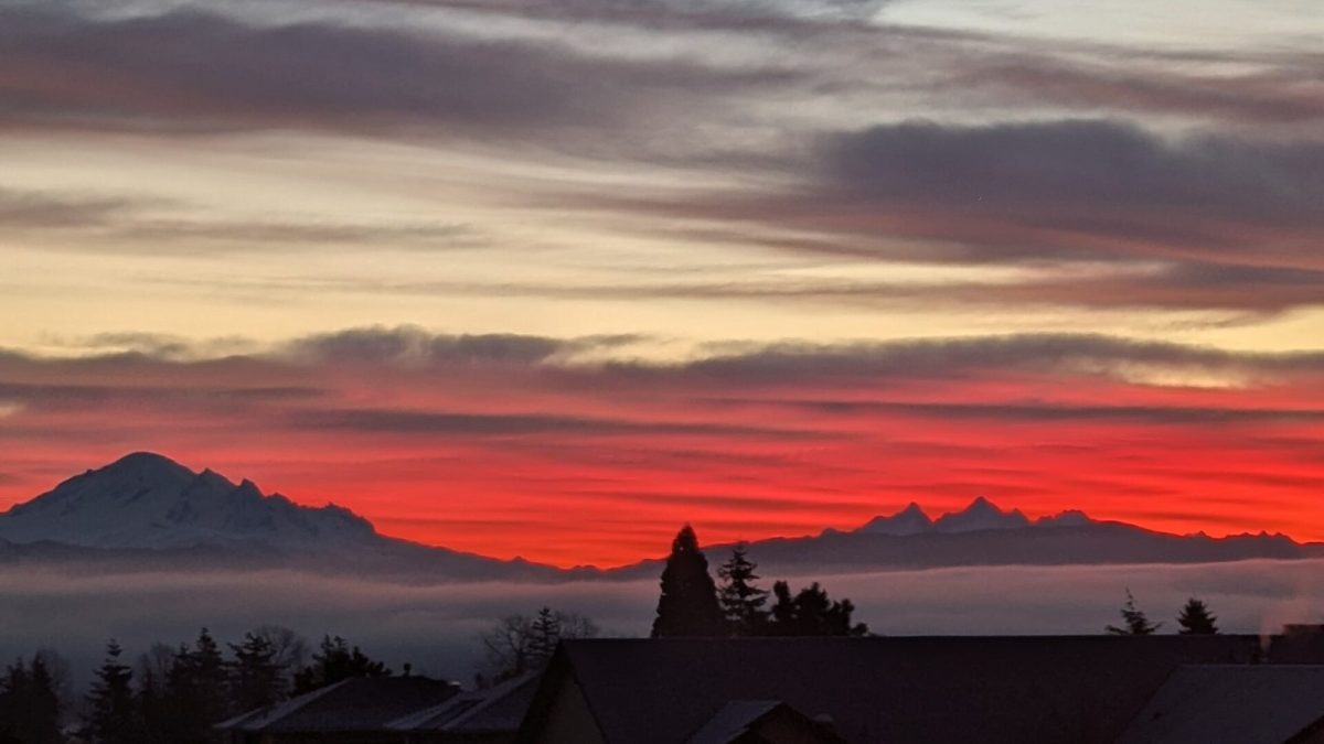
Fall color on the Mt. Baker Highway peaks in mid-to-late September at elevation: huckleberry bushes turning red across the 4,000- to 6,000-foot meadows, vine maple going orange in the understory below. There's no golden larch here — the larch corridors are Cathedral Provincial Park and the Pasayten, further east in the North Cascades. What this corridor has instead is quieter trails and ripening huckleberries, plus the start of mushroom season. Things to do near Mt. Baker covers how fall fits alongside the rest of the year.
When does fall color actually show up
Color begins at elevation in September and peaks mid-September through October, working downhill as the weeks pass. It's a taller-elevation, shorter-season kind of fall than what a Seattle or Vancouver visitor might expect from an East Coast trip — the show is in the subalpine meadows around Skyline Divide, Yellow Aster Butte, Chain Lakes, and Table Mountain, at 4,000 to 6,500 feet, and it's driven by huckleberry foliage and vine maple rather than any broadleaf forest turning en masse.
Snowpack decides the exact calendar every year, so treat any date as a rough guide rather than a booking deadline — the same is true in reverse each spring, when the same road reopens on its own unpredictable schedule. The corridor's most useful landmark is the Artist Point road: it stays open until the season's first significant snowfall closes it, which has fallen anywhere from mid-October to late in the month in recent years. Once it closes, the highest trailheads go with it until spring plowing — Table Mountain and Chain Lakes Loop among them, plus Ptarmigan Ridge.
Where the color and the huckleberries overlap
| Trail | Round trip | Gain | High point | Fall notes |
|---|---|---|---|---|
| Chain Lakes Loop | 6.5 mi | 1,820 ft | 5,400 ft | Passes Iceberg, Hayes, Arbuthnot and Mazama lakes; blueberries and huckleberries color the basin late in the season |
| Goat Mountain | 8.2 mi | 3,100 ft | 5,600 ft | Reached via FR 32, 2.1 mi off SR 542; fall huckleberries along the upper slopes |
| Church Mountain | 8.5 mi | 3,750 ft | 6,100 ft | FR 3040, 2.7 mi off SR 542; a stream ford 0.5 mi before the trailhead can stop low-clearance cars in high water, which is more common with fall rain |
| Excelsior Peak via Damfino Lakes | 5.6 mi | 1,500 ft | 5,699 ft | Strong fall color along the High Divide — but Canyon Creek Road, the access route, washed out in December 2025 with no repair timeline as of this writing. Call ahead or check a current USFS closure map before driving out |
All four require a Northwest Forest Pass except where the trail itself has no facilities. None of them are the trails that show up on a first-time visitor's list, which is the point — September on this corridor is quieter than July, and these routes reflect that.
None of them have golden needles waiting at the end, either. If a friend forwards you a larch photo and asks whether it's from Mt. Baker, it isn't — this range simply doesn't grow the species in numbers worth a special trip.
Huckleberry season, briefly
Huckleberries ripen from July through August at 4,000 to 6,000 feet, and picking generally extends into early fall wherever bushes are still holding fruit at the higher end of that range. A free personal-use permit is required from a Mt. Baker-Snoqualmie National Forest ranger district office — in person, not by phone or email — and covers a combined household cap of five gallons per year across mushrooms and berries, plus other plants, forest-wide. Designated Wilderness, including much of the Mount Baker Wilderness that borders these trails, is closed to foraging even with a valid permit. Selling personal-use quantities is a federal violation.
For the full rundown of where, when and how much, see our huckleberry picking guide.
Mushroom season starts in September
Chanterelle season generally runs October through November; matsutake runs September through October. Both fall under the same permit and five-gallon combined cap as huckleberries, and the same Wilderness closure applies — check a map before you leave the trailhead, because it's easy to wander from an open forest zone into a closed one without a sign to tell you.
Four rules apply everywhere in the Mt. Baker-Snoqualmie National Forest, regardless of which district office issued your permit:
- Get the permit in person at a ranger district office before you forage — it can't be done by phone or online.
- Track your household's combined take across mushrooms and berries — plants count too — since the five-gallon annual cap applies to all of it together, not five gallons each.
- Stay out of designated Wilderness even with a permit in hand.
- Don't sell what you pick. Personal-use permits don't cover resale, and it's a federal offense.
Our mushroom foraging guide covers permit locations and species-specific notes in more detail.
The bears haven't left yet
A forest-wide food-storage order (#06-05-25-01) has been in force since April 2025 and runs through April 2027, requiring bear-resistant storage of all food and garbage, plus any other attractant, day and night, with burnable attractants packed out rather than left in a fire ring. Black bears are active well into fall as they feed heavily before winter, and fines run up to $5,000 for an individual violation. If you're camping near any of these trailheads, this isn't a suggestion.
Camping near the trailheads
On several of the trails above and elsewhere in the corridor, camping is prohibited within two miles of the trailhead from May 15 through mid-November. That window covers essentially the entire fall hiking season, so plan on a developed campground or a cabin rather than pitching a tent near the trail itself.
A cabin base also solves the practical fall problem better than a tent does: nights at elevation are already cold by late September, and days are noticeably shorter than they were in July. Cabins in Glacier put you closest to these trailheads and closest to a hot shower afterward.
Why fall trades crowds for weather
Artist Point pulls roughly 650 vehicles a day into a roughly 160-car lot at the height of summer, which means a mid-August Saturday can mean circling for a spot. That pressure eases sharply after Labor Day. Fewer cars at the trailhead also means fewer people on trail — Chain Lakes Loop and Table Mountain, both jammed in July, thin out to something closer to solitude by late September.
The trade is weather, not just crowds. Days are shorter and mornings are colder, and afternoon rain becomes more likely as the season progresses. Layers that felt unnecessary in August earn their space in a pack by October: gloves and a real shell, plus a headlamp if you're timing a hike to catch sunset color from a ridge. None of the trails above are technical, but Church Mountain's stream ford and the exposed ridgeline sections of Goat Mountain are worse company in a downpour than in dry weather, so check a forecast rather than assuming August conditions still apply.
Wildlife is also more active through fall as animals feed ahead of winter — black bears most visibly, but also black-tailed deer and, in pockets south of the wilderness boundary, elk. None of that changes trail choice, but it's one more reason the food-storage order above isn't optional.
What's different about fall driving
Rain replaces the summer's dry gravel washboard on unpaved forest roads, and the stream ford before Church Mountain's trailhead is more likely to be a problem after a wet week than it was in August. SR 542 itself stays open later into fall than the side roads do, but check WSDOT's real-time alerts for the highway before a trip anytime after the first frost — early snow at elevation isn't unheard of even while Bellingham is still seeing rain.
FAQ
Is there fall foliage like New England at Mt. Baker?
Not in that sense. The color here is huckleberry red and vine maple orange in subalpine meadows at 4,000 to 6,500 feet, not a broadleaf forest turning en masse at eye level. It's real and worth seeing, but it's a different kind of show.
Are there larch trees near Mt. Baker?
No. The larch destinations within reach of this corridor — Cathedral Provincial Park, the Pasayten, Glacier Peak, Cascade Pass — are all in other drainages. Don't plan a Mt. Baker trip around larch photos.
When does the Artist Point road close for the season?
With the first significant snowfall, which varies by year — it's closed mid-October in some years and later in others. Check current status before a late-season trip to Table Mountain or Chain Lakes Loop.
Do I need a permit to pick huckleberries or mushrooms?
Yes, a free personal-use permit from a ranger district office, obtained in person. It covers a combined five-gallon annual cap across mushrooms and berries, plus other plants. Wilderness areas are off-limits even with a permit.
Check trail-specific road status before you drive out — several forest roads in this corridor are closed or degraded as of this writing — and confirm with the ranger district if a route isn't on this list.
*Written by the team at Stay at Mt Baker, who manage cabins in Glacier, Maple Falls,
Mt. Baker Rim, Glacier Springs, Snowline, Snowater and Silver Lake.
Last checked: August 2026.*